Maps from
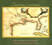
Charting Louisiana
Five Hundred Years of Maps
Edited by Alfred E. Lemmon, John T. Magill, and Jason R. Wiese
Charting Louisiana, published by the Historic New Orleans Collection to celebrate the bicentennial of the Louisiana Purchase, is an unprecedented compilation of 193 high-quality reproductions of important maps illustrating the development of Louisiana from the early sixteenth century to the present, along with historical essays providing a broader context for understanding the maps.
The thumbnails below reproduce nine maps from the book; click on each thumbnail to see a larger image. Please note two things: (1) The individual image file sizes range from 150 to 400 kB—they make take several minutes to download on modem connections. (2) File size notwithstanding, pictures transferred electronically over the internet do scant justice to the richness of the illustrations in the book.
Maps from Charting Louisiana
;)
12. Les Costes aux Environs de la Riviere de Misisipi, Decouvertes par Mr. de la Salle en 1683 et reconnues par Mr. le Chevallier d'Iberville en 1698 et 1699 by Nicholas de Fer. 1701. The Historic New Orleans Collection This and other maps by Nicolas de Fer defined the geographical space of Louisiana with an ornamental flair. Here, de Fer highlights information gleaned by the expeditions of La Salle and Iberville. While the map's title makes a slight mistake concerning La Salle's 1682 "discovery" of the Mississippi River, it served at the time to more accurately identify reality in the face of long-held myths about the region. For nearly two centuries, mapmakers often lost or misplaced the Mississippi River on maps, but here its relationship to Lake Pontchartrain and the Gulf of Mexico indicates a growing awareness of its correct placement. De Fer drafted this map as a crisis unfolded in Europe concerning the heir of Carlos II of Spain, who had died the previous year. The selection of a French heir angered some Spaniards, as well as European colonial powers wary of a potent Spanish/French alliance. Tensions rose between France and Spain at this time, particularly with regard to French activity on the Gulf Coast. Though de Fer's map features the site of La Salle's ill-fated colony near Matagorda Bay in modern Texas, the title cartouche also dramatizes the explorer's tragic death at the hands of his own men. ;)
25. A New & Accurate Map of Louisiana, with Part of Florida and Canada, and the Adjacent Countries…by Emanuel Bowen. [London, 1747]. The Historic New Orleans Collection Although the French were well entrenched in Louisiana by the 1740s, the British remained interested in the area for their own colonial expansion. Bowen shows European settlements along with some Indian nations. Unlike many mapmakers of his time, he credited his sources for this map, most notably the great French mapmaker Jacques Nicolas Bellin. Bowen received appointments as engraver of maps to King George II of England, as well as Louis XV of France. ;)
74. Louisiana from Mathew Carey's General Atlas Improved and Enlarged: Being A Collection of Maps of the World and Quarters…[Philadelphia, 1814]. The Historic New Orleans Collection Mathew Carey became a pioneer American map publisher following his immigration to Philadelphia from Dublin in 1784. Carey set up a publishing firm financed by the marquis de Lafayette, with whom he had earlier become friends in Paris. His success in publishing Guthrie's Geography Improved led him to similar projects. Carey's American Atlas of 1795 was the earliest atlas of the United States. His American Pocket Atlas, in which the map of Louisiana appeared, was published in editions of 1796, 1801, 1809, 1813, and 1814. He had issued the earliest printed map of Louisiana as a state in 1813, which appears here in an enlarged version from his 1814 General Atlas. This map was probably compiled by Samuel Lewis, Carey's principal mapmaker. ;)
152. U-Boote im Golf von Mexiko 1942-1943 by Carl D. Vought [Huntsville, Ala.], 1986. The Historic New Orleans Collection This 1986 facsimile map, based on historical data, highlights the extreme danger that German submarine warfare posed to ships exiting the Mississippi River into the Gulf of Mexico. The German Kriegsmarine used a coded grid system to plot U-boat positions, designating the area of the gulf south of New Orleans as DA90. During the years 1942 and 1943, perhaps no area of the sea was deadlier to merchant sailors than DA90; many tankers and freighters fell prey to the U-boats dispatched there. Submarines also prowled Louisiana's coasts during World War I, when at least one disabled German U-boat was captured and towed up the Mississippi River to New Orleans. This map demonstrates the proximity of World War II to the very doorstep of Louisiana. Copyright notice: ©2003 All maps reproduced from Charting Louisiana: Five Hundred Years of Maps edited by Alfred E. Lemmon, John T. Magill, and Jason R. Wiese, published by the Historic New Orleans Collection. All rights reserved. No use allowed without permission. |
;)
21. A Map of Louisiana And Of The River Mississippi by John Senex. London, [1718 or 1719]. The Historic New Orleans Collection A restless band of Carolina tranders—who crossed the Appalachian Mountains seeking closer economic relations with Native American nations to the west—galvanized English interest in Louisiana and the Mississippi River valley. In light of this development, English mapmaker John Senex responded to market demands with this map, copying liberally from Guillaume de L'Isle's ca.1718 Carte de la Louisiane et du Cours du Mississipi. This plagiarism did not, of course, include L'Isle's notation about French claims to Carolina. Interestingly, Senex dedicated his map to William Law, the father of financier John Law, whose scheme to develop French Louisiana eventually caused the ruin of many European investors. ;)
22. Carte Particuliere Du Flevue [sic] St. Louis dix lieües au dessus et au dessous De La Nouvelle Orleans…[ca. 1723]. Newberry Library, Chicago New Orleans and its environs are well depicted in this impressive manuscript map that identifies names of landowners. It includes, at lower left, the "Habitations des Allemands," or the German Coast, during the first decade of its settlement. In addition to naming landowners, the mapmaker indicated buildings within each landholding. This early rendering shows the long, narrow land concessions usually based on a specified frontage on the Mississippi River or other waterways. These characteristic French "long-lots" placed an indelible mark on the landscape of south Louisiana and influenced the subsequent development of the area. Vestiges of the system can still be seen today in the placement of roads and boundaries. ;)
27. Le Missisipi ou la Louisiane Dans l'Amerique Septenrionale by François Chereau. [ca. 1720]. The Historic New Orleans Collection This richly illustrated printed map provides a curious and obviously inaccurate bird's-eye view of Louisiana's gulf coast. Waterways, islands, settlements, forts, and Indian villages are numbered and keyed into an index below the image. Marauding natives brandish bows and arrows. New Orleans is prominent, though on the wrong side of Lake Pontchartrain and very close to the Gulf of Mexico. Chereau probably intended to gratify a European community thirsting for information about Louisiana. Such an audience would possess little information to confirm or deny the accuracy of his presentation. ;)
79. Map shewing the landing of the British Army its several Encampments and Fortifications on the Mississippi…by Arsène Lacarriè Latour. 1815. The Historic New Orleans Collection Under orders from General James Wilkinson, Latour and Barthélémy Lafon joined forces in 1810 to prepare maps of southern Louisiana. During the War of 1812, as the British approached New Orleans, Latour devoted his energies to preparing maps of various areas along the Gulf of Mexico. Following the American victory at the Battle of New Orleans, Latour compiled and published his Historical Memoir of the War in West Florida and Louisiana (1816), which included nine folded maps, one of which is reproduced here. This plan shows the routes of different British Army corps in their advance on New Orleans, as well as the areas they held prior to their defeat. ;)
169. Plan De La Ville La Nouvelle Orleans Capitale De La Province De La Loûisiane by Thierry. [New Orleans], 1755. The Historic New Orleans Collection This romanticized manuscript city plan depicts existing major landmarks, such as the Church of St. Louis on the Place d'Armes, but exaggerates the development and extent of the town with its many gardens. The incomplete fortification moat—still in existence in 1755—is noticeably absent. Thierry shows New Orleans at an auspicious time, namely the beginning of the French and Indian War. This conflict, along with the broader turmoil in Europe, led to the transfer of the colony from France to Spain in 1762. | |
Alfred E. Lemmon, John T. Magill, and Jason R. Wiese, editors
Charting Louisiana: Five Hundred Years of Maps
©2003, 448 pages, 193 maps in color, 14 x 12
Distributed for the Historic New Orleans Collection
Cloth $95.00 ISBN: 0-917860-47-0For information on purchasing the book—from bookstores or here online—please go to the webpage for Charting Louisiana.
See also:
- Our catalog of Cartography titles
- Other excerpts and online essays from University of Chicago Press titles
- Sign up for e-mail notification of new books in this and other subjects